Switch map types on routes and activities to take advantage of all the map options that we provide. Different maps provide slightly different location data, allowing you to gain additional information, or better tailor your route to your preferences.
_____________________________________________________________________
Download the Ride with GPS mobile app
_____________________________________________________________________
Our default map type is our custom RWGPS Cycle map, which displays walking paths, various types of cycling and cycling-friendly infrastructure, roads, and highways.
Map Types on the Web
Available Map Types
RWGPS Cycle
The Ride with GPS map type is our signature map type and is based on OpenStreetMap (OSM) data.
RWGPS Cycle legend
When you're viewing the RWGPS Cycle map type on our website, click the map legend icon to view the RWGPS Cycle Map legend.
Here's the full RWGPS Cycle Map Legend.
- Cycling Friendly Roads: Paved and unpaved roads designated for lower traffic. Sometimes marked as “greenways” or as a local “bicycle network,” featuring shared-lane markings, commonly known as “sharrows.”
- Roads with Bike Lanes: Paved surfaces designed for both motorized vehicles and bicyclists, featuring clearly marked zones for bicycle traffic in the form of painted lines or physical barriers.
- Cycleways & Cycling Designated Paths: Dedicated, fully-paved paths designed for bicyclists, physically detached from roads utilized by motorized vehicles.
- Cycling-Friendly Paths: Paved and unpaved surfaces dedicated to non-motorized traffic, sometimes shared with pedestrians.
Google Map
- Google Map displays the classic Google map type.
-
With Google Map selected, you can enable Google's Bike Paths data in the web Route Planner. Click Bike Paths to display this information. Google has more details about their bike path legend here.
Note: Google Bike Paths data is only visible with the "Google Map," "Google Terrain," and "Google Hybrid" map types.
Google Satellite
- The Google Satellite map type serves up Google's satellite imagery, which can be useful for determining the width of a road or further examining surface type and infrastructure.
Google Hybrid
- The Hybrid Google map type displays satellite imagery alongside Google Map view data, including street names, businesses. This map type can show Google bike path data in the web Route Planner.
Google Terrain
- Displays the Google Map view with map contours.
- Bike Paths in the Route Planner can also be enabled in this map type.
OSM
- Displays OpenStreetMap data. OSM is an open-source map that covers the entire world.
- Anyone can submit changes to OpenStreetMap. Check out our help page on how to submit changes for mapping errors or adding new, local trails to OSM maps.
- You can view the OSM map legend at https://wiki.openstreetmap.org/wiki/OpenStreetMap_Carto/Key.
OSM Cycle
- Displays a variation of OpenStreetMap focused on cycling-specific data.
- View the legend for this map type here: opencyclemap.org/docs/.
OSM Outdoor
- Displays OpenStreetMap data with elevation contours.
ESRI Topo
- Displays ESRI (Environmental Systems Research Institute) topographic map data.
USGS Topo
- Displays United States Geological Survey Topographical map data.
USGS Scans
- Displays scanned map data by the United States Geological Survey.
Google Street View
-
You can access Google Street View to drop into your route and see the street view.
Note: Google Street View isn't available in all areas.
- Google Street View can be accessed on the website in the Route Planner, Route and Activity Summary Pages, Collections, Events, and Explore.
To use Google Street View:
- View the Route Planner, a Route or Activity Summary Page, the Explore map, an Event map, or a Collection map on the website.
- Click and drag the yellow "pegman" icon from the lower right corner of the map to a blue highlighted section on the map to view a street view perspective. You can also drop the icon onto a blue dot on the map to view a photosphere. These are 360-degree shots that allow you to see in places that roads may not normally go.
- Click and drag the image in Street View to rotate the view. Click the arrows within the view to travel along a road.
- To exit Street View, click the return arrow in the box just above the elevation profile, or press the ESC key on your keyboard.
Change Map Types for Routing Issues
You can change the map type to display different map data. You may find that some trails and roads show up on certain map types and not on others, or that some map types won't allow you to route on a closed road, while others will.
Our Route Planner uses data from OSM or Google to plot routes. If you ever come across a section of road that won’t route properly, change the map type and retry your routing. You can always switch between a few different maps during planning to see all your options.
Switch Map Types on the Mobile App
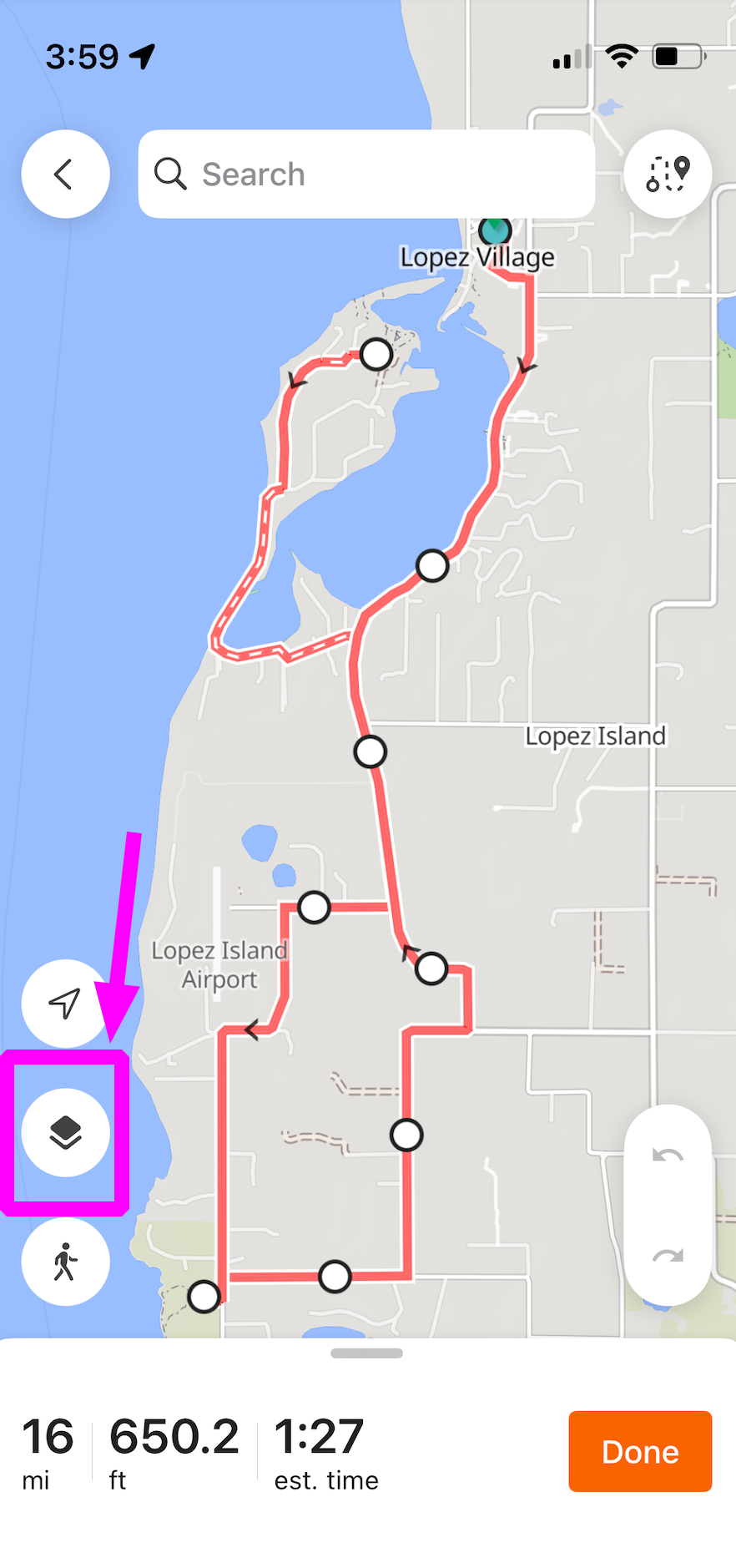
Map types on the mobile app are sourced by Mapbox, which provides OSM map data. To switch your map type on the app, tap the map overlay icon in the lower left corner of your screen when viewing a map, then tap to select your preferred map type. More information can be found in our Mobile Route Planner help page.
Related to